The 136 km-long Hantangang River runs from Pyeonggang-gun County in North Korea through Cheorwon-gun County in Gangwon-do Province, the city of Pocheon and Yeoncheon-gun County, Gyeonggi-do Province, and further to the Imjingang River in the southern half of the Korean Peninsula.
The river's basin region on July 7 was designated a UNESCO Global Geopark at the 209th session of the UNESCO Executive Board in Paris. The area received recognition for its picturesque views of nature created by hot lava that flowed 50,000 to 100,000 years ago and cold water, as well as the pristinely clean ecosystem of the Demilitarized Zone section in Cheorwon-gun.
Hantangang National Geopark covers 1,164.73 square km comprising 493.3 square km of Pocheon, 398.06 square km of Cheorwon-gun and 273.3 square km of Yeoncheon-gun. This is the country's fourth UNESCO Global Geopark following those on Jeju Island, Cheongsong-gun County in Gyeongsangbuk-do Province and Mudeungsan Mountain, and the world's 148th park of its kind.
Korea.net on July 27 visited the geopark to learn more about the river's clean nature and history. The trip began at 10 a.m. from Soyosan Station of the No. 1 line of the Seoul subway in Dongducheon, Gyeonggi-do Province. Staff in a car visited key attractions such as Jaeinpokpo Falls in Yeoncheon-gun, Soisan Mountain in Cheorwon-gun and Bidulginangpokpo (Pigeon) Falls in Pocheon.
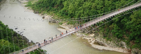
The geopark is the only one of its kind in the country formed along a river. The U-shaped gorge there is 30-50 m tall, and along with the waterfalls and columnar joints, presents magnificent panoramic scenery.
Seo Seong-Cheol, commentator of the geopark, said, "The Hantangang River holds high geological value as it has well-preserved geological features rarely seen in inland areas, such as pillar-shaped columnar joints and pillow lava created by cooled lava that directly erupted from under water."


Getting to Jaeinpokpo Falls takes a 30-minute drive north from Soyosan Station. See a wonderful view of the stream flowing from Jijangbong Peak in North Korea and falling from the 18 m-high cliff of basalt columnar joints. And expect a dizzyingly breathtaking scene of the waterfalls and the area surrounding the gorge from the skywalk lookout in front of the falls.
Kim Daewoo, a geoscientist for tourism at Yeoncheon-gun County Office, said, "The 18 m-high waterfall kept eroding the bottom to form a large pothole 5 m deep."
Unlike the majestic Jaeinpokpo Falls, Bidulginangpokpo Falls attracts visitors with a peaceful and mystic atmosphere and is named after the pigeon's nest shape of the surrounding basalt gorge. In addition to a gorge created by the river's erosion, the area also boasts unique geological features such as columnar joints and sheeting joints, which are concentric circle-looking cracks as seen from rocks.

Traveling to Cheorwon-gun from Yeoncheon-gun is tiring because the winding path has many ups and downs. But the exhaustion from hiking is soon forgotten after seeing the view of the green Cheorwon Lava Land and feeling the cool breeze at the peak of Soisan Mountain.
Soisan rises 362 m above sea level on the Cheorwon Plain. The mountain was the site of a U.S. military base after the Korean War and remained off-limits to civilians for 60 years. When the Ministry of National Defense in 2012 opened the area to the public, it also unveiled a forest trail named Soisan Eco-forest Green Path. Apart from this walkway, the rest of the mountain path surrounding the barbed wire fence is covered with landmines. Visitors reaching Soisan's peak after going through a deep forest can expect a spectacular view of the Cheorwon Lava Land and North Korea from behind the DMZ.
Created by a basalt volcano eruption that occurred about 60 million years ago, this large plain is the country's only lava area that is observable inland. Visitors to Cheorwon-gun can learn not only about Baengmagoji Battlefield, the site of a fierce battle during the Korean War, and the old building of the Cheorwon-gun branch of the North's Workers' Party but also habitats for migratory birds that fly to Korea every winter.
Geopark commentator Seo said, "Hantangang National Geopark is an integrated tourism resource that combines geology, ecology, history and culture."
"Visitors can enjoy the beautiful scenery gifted by nature no matter what season it is."
Recommended one-day exploratory course
Route: Seoul to Jaeinpokpo Falls in Yeoncheon-gun County, Gyeonggi-do Province, to Soisan Mountain in Cheorwon-gun County, Gangwon-do Province
Distance: 125 km one-way (car needed)
Lunch recommendations: megi maeuntang (catfish fish stew), chamge maeuntang (land crab stew)
Source: www.korea.net